
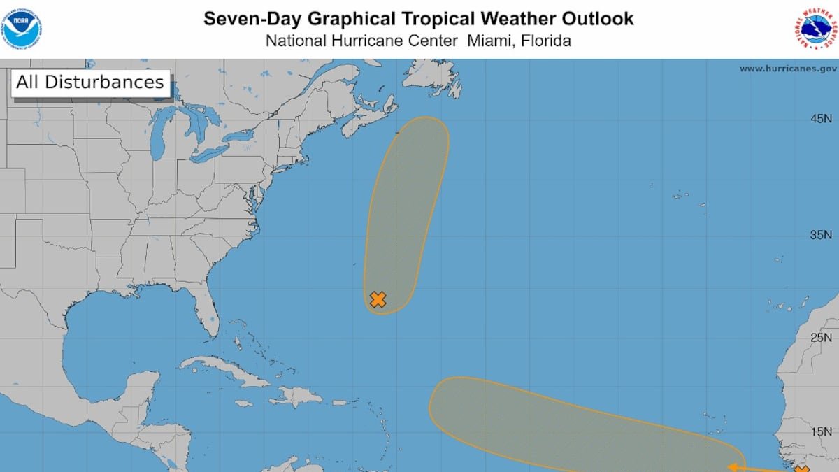
The National Hurricane Center is eyeing two systems in the Atlantic with medium chances of becoming the next named storm of the season — Dolly. One is worth watching for Florida.
The first disturbance, a low pressure area a few hundred miles southeast of Bermuda, could become a short-lived tropical depression or storm and steer north, away from the Atlantic Coast and into the open ocean.
As of 8 a.m. Monday, the hurricane center held its chances of formation at 50% for the next two to seven days.
The other disturbance is the one the Caribbean and Florida are keeping a closer watch on.
This tropical wave was rolling off Africa’s west coast early Monday, and forecasters said conditions in the otherwise unfriendly Atlantic might line up to give this one a shot at strengthening by the middle to end of the week.
As of 8 a.m. Monday, the hurricane center upped its chances of development to 60% for the next seven days and 20% in the next two days.
Long range storm models continue to be confused about the potential future of this system. Some show it fizzling out after tracking west into the Caribbean as a tropical storm, others show it flirting with hurricane status and curving northwest.
“A recurve away from land seems most likely in the long range, but of course it’s a long way out,” wrote Andy Hazelton, an associate scientist at the University of Miami studying hurricanes, on X Monday morning.
• • •
Tampa Bay Times 2026 hurricane guide
The 2026 hurricane season is here. Here’s what the forecasts say
What is a ‘super El Niño’? And what does it mean for hurricanes in Florida?
What to know about river flooding in Tampa Bay this hurricane season
Hurricane forecasts are overwhelming. Here’s how to read them
What should you pack in your storm kit? Here’s where to start
Get Times storm alerts on all your devices
How Tampa Bay seniors, others can get help evacuating
How to handle fires, tree limbs and other hazards after a storm
Here are the lessons you learned from Tampa Bay’s historic 2024 hurricane season