
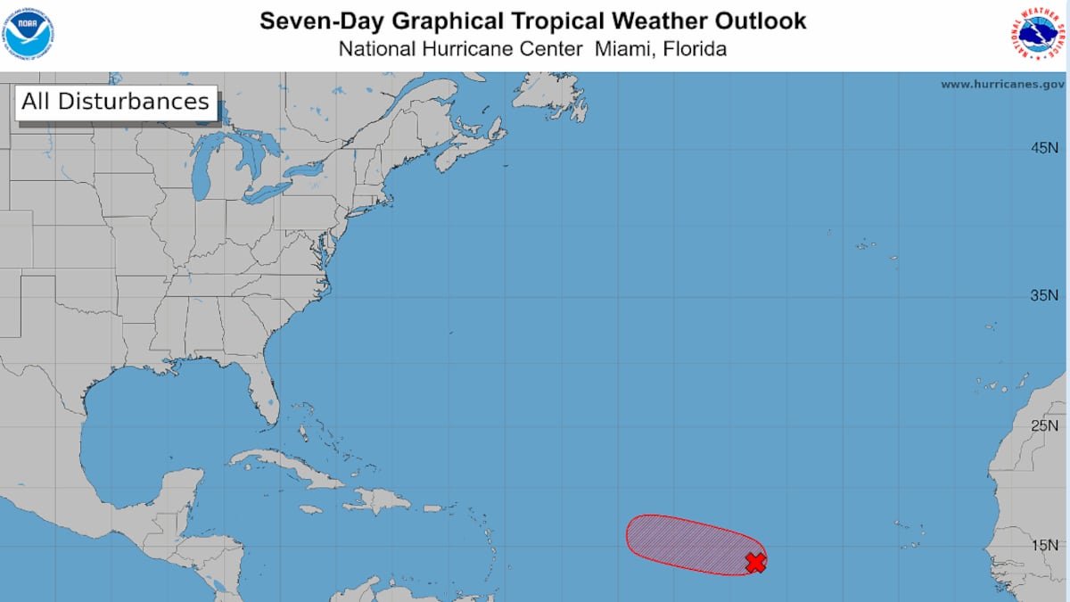
Despite intense wind shear and other hostile conditions for Atlantic storms this season, another named storm may beat the odds and form soon — potentially as early as Thursday afternoon.
The National Hurricane Center raised the odds that a tropical wave it’s been tracking for days could strengthen into a tropical depression or storm to 90% in the next two to seven days, as of 8 a.m. Thursday.
Forecasters said it has a slim window for beefing up, just until Friday, when storm-unfriendly conditions could ramp up again. If ti does form, it would be named Dolly.
But plenty of long-range computer models continue to show a future for the system, most as a tropical storm headed west toward the Caribbean, although plenty also show a potential track that curves north of Puerto Rico.
If something does develop, it wouldn’t be near the Caribbean until early next week or near Florida until mid to late in the week.
“The area around FL, the Bahamas, and SW Atlantic is one of the only places in the entire Atlantic Ocean basin that is somewhat favorable for tropical development right now this year,” Noah Bergren, meteorologist for Fox35 Orlando, posted on X Thursday morning.
Although he said that he’s not worried about the storm yet, because it’s so far off, Bergren noted that a storm that tracked weaker and further south has a higher chance of survival going forward.
• • •
Tampa Bay Times 2026 hurricane guide
The 2026 hurricane season is here. Here’s what the forecasts say
What is a ‘super El Niño’? And what does it mean for hurricanes in Florida?
What to know about river flooding in Tampa Bay this hurricane season
Hurricane forecasts are overwhelming. Here’s how to read them
What should you pack in your storm kit? Here’s where to start
Get Times storm alerts on all your devices
How Tampa Bay seniors, others can get help evacuating
How to handle fires, tree limbs and other hazards after a storm
Here are the lessons you learned from Tampa Bay’s historic 2024 hurricane season